
News
Summers Will Not Finish Semester of Teaching as Harvard Investigates Epstein Ties

News
Harvard College Students Report Favoring Divestment from Israel in HUA Survey

News
‘He Should Resign’: Harvard Undergrads Take Hard Line Against Summers Over Epstein Scandal
News
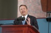
Harvard To Launch New Investigation Into Epstein’s Ties to Summers, Other University Affiliates

News
Harvard Students To Vote on Divestment From Israel in Inaugural HUA Election Survey
WASHBURN SPEAKS ON ADVENTURES IN YUKON
Talks Before Harvard Travelers' Club Accompanied by Colored Plates and Moving Pictures
Speaking on his "Aerial Adventures in the Yukon," Henry Bradford Washburn, Jr. '33, young explorer, last night entertained the members of the Harvard Travelers' Club in the Geographical Institute auditorium.
Illuminating his talk with an almost continuous series of colored plates and moving pictures, he spoke for over an hour and a half on the mapping expedition fostered by the National Geographic Society with the aid of the Canadian Government.
Because of the almost insurmountable St. Elias Range which runs along the southern section of the Alaskan-Yukon border, the International Boundary Commission around 1900 was able to survey only from the Alaskan side. It was upon the uncharted Canadian side that Washburn did his work from February to June of this year.
The expedition of less than a dozen took the White Pass and Yukon Railroad up from Skagway to Carcross, 70 miles northeast. This bleak, one-hotel town served as base for the two airplanes by which the area to be mapped was completely photographed. Upon these photographs the overland sledge journey for the actual surveying was planned.
The expedition discovered three peaks over 14,000 feet, 19 over 10,000 feet, and 25 over 9,000 feet. They named one of the largest glaciers in the north for President-emeritus Lowell.
Want to keep up with breaking news? Subscribe to our email newsletter.